ShopDreamUp AI ArtDreamUp
Deviation Actions


Suggested Deviants


Suggested Collections


You Might Like…


Description
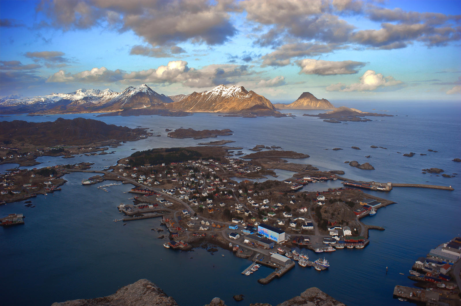
Ballstad, Lofoten islands.
This beautiful hike follows at first the coast, sometimes closer sometimes further up along the foot of the mountain 'Brurstolen'. After a short time you will have a splendid view along the southern coast of the Lofoten towards Soervagen and even to the small island Roest. Coming around Brurstolen you will see along Nappstraumen northwards along the much more rocky mountains on the other side. From here the more strenous part beginns and you will need to hike up about 220 meters in altitude to reach the saddle. On there you can either walk up to the peak of Brurstolen or towards Skottinden (with 671 meters). My hike just continued towards Ballstad. After some 300 meters you will come to the edge from where you will decend down direction Ballstad. At first you will only see the small sparetime harbour, but then there is a fantastic view over the whole town. At some point there is very small flat area, where I cooked my food and sat down to watch the town while eating. Now there is only the last descend and you are back from where you came. If you are lucky during your trip you might see different birds like eagles or maybe a whale.
About the trail: First of all you should have a topographic map with you, which is available in all bigger towns on Lofoten (Leknes, Svolvaer etc.) or also in Narvik (two shopping center in downtown) if you come by car. To get to the trail head, follow the road 818 through Ballstad to the almost end. Then turn right to get to the 'sparetime' boat harbour. Don't worry, coming there it is pretty obvious as you will need to get around very close to the southern side of the mountain. So after leaving the 818 drive 100 meters and put your car here. Follow the road. It will turn left to a bridge, but keep on going. You will pass stockfish drying places. Now it will turn to a small path which you just follow. The next difficulty will wait much later to find the right spot to get up the hill. I missed it and had to walk straight up 'cross country style'. This is quite exhausting. So here a hint. There are two spots where the trail leads through a sort of cave under rocks After the second 'cave', there must be the trail leading up the hill. I could see the trail coming up the hill pretty good after arriving at the top. Maybe I was too busy watching the landscape and taking photos. As soon you get up the hill it is easy again, just follow the trail. Additionally there are stone piles once you reach the top of the saddle helping to orientate.
Image size
4284x2844px 7.34 MB
© 2012 - 2024 steinliland
Comments4
Join the community to add your comment. Already a deviant? Log In
So beautiful. Makes me miss Lofoten!